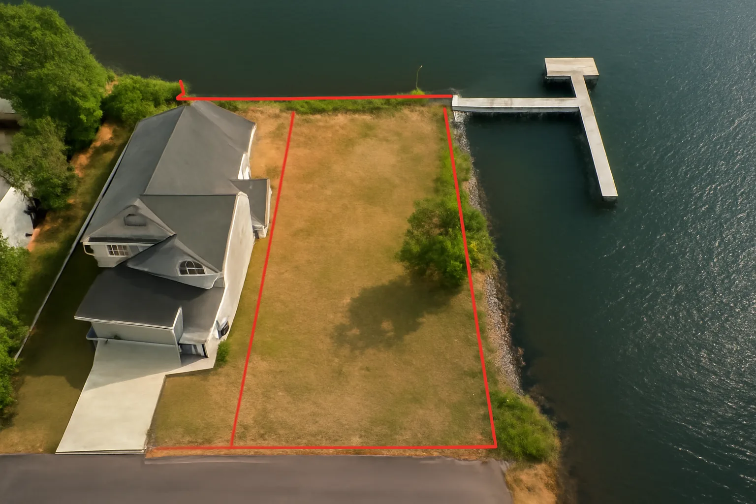
Hurricane season along the Gulf Coast has a way of exposing what people don’t understand about their waterfront boundaries. When storm surge and flooding recede, property owners discover that the dock they built, the seawall they reinforced, or the fill they added sits partially on someone else’s water corridor — or on state-owned submerged land they never had permission to touch. Gary’s situation was one of those expensive revelations. He’d invested $18,000 in a dock without grasping what riparian rights waterfront property actually meant in his jurisdiction. County code enforcement found that 14 feet of his decking encroached on a shared water corridor. Removal and fines came to just over $3,200. That’s a pattern I’ve witnessed repeatedly across my two decades building and repairing marine structures on the Gulf Coast. Riparian rights aren’t abstract legal concepts—they’re the operating boundaries that dictate what you’re permitted to construct, where those structures can sit, and whether the water access you assume you own is actually yours to use.
My background includes two decades pulling permits on waterfront property across six states, wrestling with Army Corps of Engineers Section 404 requirements, and resolving boundary disputes while standing in chest-deep water with surveyors. The pattern I’ve noticed repeating itself is straightforward: waterfront property ownership does not automatically grant control over everything extending waterward from your lot line. Many capable people have made costly errors by conflating property deed language with actual construction rights. What stops the bleeding is understanding the regulatory landscape before you commit money or materials.
This post targets waterfront owners who are new to riparian regulations and want a straightforward breakdown without legal jargon. I’ll walk through what riparian rights actually authorize you to do, how those rights shift depending on your state, what specific limitations apply to docks and shoreline work, and how to insulate yourself from legal and financial exposure. Let’s move forward.
What Are Riparian Rights? The Basics Every Waterfront Owner Needs
Riparian rights are the legal entitlements that flow from owning land adjacent to flowing or standing water. The term traces back to the Latin word ripa, which translates to riverbank. At its core, riparian doctrine establishes the legal framework through which you interact with the body of water touching your parcel. These rights encompass access privileges, usage parameters, and occasionally—depending on where you are—partial or full ownership claims over the water column or the soil beneath it.
Across the majority of American states, riparian law grants you the privilege of “reasonable use” of adjacent water. That translates into activities like swimming, angling, launching vessels, and constructing a dock. The operative word is reasonable. You cannot deploy the water in ways that substantially harm neighboring owners’ ability to exercise their own riparian entitlements. Disputes germinate in that ambiguous middle ground where your interpretation of “reasonable” collides with your neighbor’s interpretation.
A crucial clarification sits between riparian and littoral rights. Riparian doctrine typically governs land parcels touching rivers, creeks, and landlocked reservoirs. Littoral doctrine applies to properties abutting tidal saltwater bodies—the Gulf, bays, tidal estuaries. If your property is on the Gulf Coast, as most around here are, you’re operating within a littoral framework. This distinction carries practical weight when determining who holds title to the underwater soils where your dock pilings will rest.
Who Actually Owns the Underwater Terrain and the Water Column Above It?
This creates discomfort for most people purchasing waterfront property for the first time. In saltwater zones, title to submerged soils typically vests with the state, extending from the mean high-water boundary outward. Your deed-described acreage terminates at the water’s regular crest. For freshwater impoundments, submerged soil title splits differently across jurisdictions. Certain states apply the “ad medium filum” framework—you hold title through to the centerline. Other states have declared all underwater ground as state property. Get a professional survey before breaking ground; make certain it explicitly addresses underwater boundaries and title.
How Riparian Rights Differ Across State Lines—Variations That Catch Contractors Off Guard
In 2009, a dock contract took me to the Florida Panhandle. My knowledge base came from Texas regulations, and I assumed the fundamentals would translate. Florida’s sovereign submerged lands statute introduced state-level permitting layers that weren’t part of my Texas mental model. That knowledge gap created three months of delay and approximately $1,400 in expedited review charges that the owner absorbed.
Riparian doctrine lives almost entirely within the state regulatory domain. Federal law does not issue a unified riparian statute. The federal footprint centers on navigable waterway management—the Army Corps of Engineers administers Section 404 of the Clean Water Act and Section 10 of the Rivers and Harbors Act from 1899. However, the underlying ownership and use entitlements flow from state sovereignty. This structure produces the result that an identical dock construction passes local approval in one state but demands a four-permit gauntlet in another.
The following represent the primary regulatory dimensions that fluctuate from jurisdiction to jurisdiction:
- Water mark boundaries determining ownership limits: Some jurisdictions extend your title to ordinary high-water elevation; others cap ownership at mean low-water elevation.
- Residential dock footprint and area caps: Florida caps most residential dock overwater area at 500 square feet in the majority of coastal zones. Texas applies different ceilings based on waterbody classification.
- Distance requirements from adjacent property corners: Most regions require 15–25 foot separation from neighbors’ lot lines, though some high-density waterfront areas compress this to 10 feet.
- Channel clearance standards for boat traffic: Your construction cannot squeeze navigation corridors. Federally mandated clearance minimums apply to navigable channels.
- Conservation zone and habitat restrictions: Eelgrass preservation corridors, marine mammal protection zones, and wetland transition buffers can effectively foreclose construction even if riparian entitlements exist.
Before committing funds to a single material purchase, reach out to your state’s department handling environmental stewardship or coastal zone management. In Florida, contact the Department of Environmental Protection. Texas waterfront builders work through the Texas Commission on Environmental Quality. Equivalent agencies exist in every coastal state. Budget $200 for a preliminary consultation meeting with the permitting authority. That investment will protect you against tens of thousands in rework or removal costs.
What Your Riparian Entitlements Actually Permit You to Construct—and Critical Gaps in That Authority
Let me be explicit: holding riparian rights does not automatically clear the path to construct any structure you envision at your water’s edge. Rights and permits operate in separate domains. Riparian entitlements create your legal standing to petition for permits. The permits themselves derive from standalone local, state, and federal regulatory frameworks that exist independent of your property deed.
From what I’ve run into, these specific waterfront projects trigger the most friction around riparian claims and permitting pathways:
- Permanent pier and dock systems: Demand local construction permits and typically state environmental authorization. Corps of Engineers permits become mandatory on navigable waterways.
- Temporary or floating dock platforms: Regulatory treatment frequently diverges from fixed installations. Some states streamline permitting, but presume you need authorization regardless.
- Boat shelter structures: Usually subject to the most stringent controls. Walled or roofed boathouses face outright prohibition across many coastal jurisdictions.
- Erosion barriers and bulkhead installations: Permitting is nearly universal. Anticipate a 60–120 day approval window in typical coastal regions.
- Water edge reconfiguration through fill or armor stone: Federal Clean Water Act authority applies. Securing permits is non-negotiable in this category.
A Mississippi client engaged me last spring wanting to add 200 additional square feet of floating platform to his authorized dock footprint. He rationalized that the modest expansion bypassed the paperwork requirement. County enforcement personnel saw it differently. His minor extension triggered a full re-examination of the original permitted dock configuration—consuming four additional months on the project schedule. Small expansions do not qualify for automatic exemptions. Verify the regulatory path before construction commences.
Community Water Access and Recorded Access Rights
Certain waterfront parcels include restrictions in their title documentation granting neighbors or community members passage across your shoreline. These take the form of recorded deed restrictions, easements created through decades of uninterrupted use, or public trust doctrines preserving historical access corridors. Put plainly, if a public boat ramp or beach access historically crossed your property boundary, state law may prevent you from closing that passage—even following purchase. Engage a waterfront real estate attorney to examine your title report; specifically request analysis of whether water corridor easements or public access claims attach to your parcel before closing.
The Framework That Would Have Spared Gary His $3,200 Fine and Removal Costs
Riparian entitlements shift substantially depending on your location and local governance—and you will not decode them through neighbor conversations or assumptions rooted in your property paperwork. Before you excavate a footer hole or place a materials order, you need reference material that actually addresses the specific riparian framework and restriction architecture in your jurisdiction.
What functions well
- Translates riparian entitlements, lateral separation requirements, and protected water corridor rules into accessible language that bypasses legal terminology—you won’t require attorney consultation just to parse what construction remains allowable
- Guides you through the full ownership arc starting from acquisition through active stewardship, preventing the scramble to understand rules after you’ve already signed title
- Provides jurisdiction-by-jurisdiction case examples and scenario walkthroughs demonstrating concrete results and actual boundary applications, which embeds the principles more effectively than generalized waterfront guidance
What falls short
- Concentrates on Rhode Island’s particular riparian scheme—if your property sits outside that state, you must adapt the framework against your local code and ordinance text
- Cannot substitute for direct conversation with your county recorder’s office or a regional waterfront attorney in boundary gray zones or edge-case scenarios
I almost made Gary’s mistake myself before I found a resource that actually explained what those mysterious survey notations meant on my property. Buying, Owning, and Selling Rhode Island Waterfront and Water View Property became my reference guide before every single build.
Frequently Asked Questions
How much did Gary’s dock encroachment cost him in fines and removal?
Gary’s encroachment on 14 feet of shared water corridor cost him just over $3,200 in removal and fines combined. He’d originally invested $18,000 in the dock without understanding riparian rights in his jurisdiction, making it an expensive lesson in checking regulations before construction.
What’s the maximum residential dock size allowed in Florida?
Florida caps most residential dock overwater area at 500 square feet in the majority of coastal zones. Texas applies different ceilings based on waterbody classification, so you’ll need to verify the specific limits for your state before designing your dock footprint.
How long should I budget for erosion barrier and bulkhead permitting?
Erosion barriers and bulkhead installations typically require 60–120 days for permitting approval in typical coastal regions. Budget that timeline into your project planning before ordering materials, since permitting is nearly universal for this category of shoreline work.
What does a preliminary consultation cost with my state’s permitting authority?
Budget $200 for a preliminary consultation meeting with your state’s permitting authority before committing to material purchases. That investment protects you against tens of thousands in rework or removal costs by clarifying what construction remains allowable in your jurisdiction.
Sources and further reading
About This Article

Written by Trent Hollis. Waterfront homeowner turned DIY obsessive. After two decades tinkering with my own dock, seawall, and boat lift on the Gulf Coast, I share everything I've learned about waterfront construction, boat lift maintenance, and coastal living projects. More about this site.
Scope and limits. Trent is a waterfront homeowner, not a licensed marine contractor. Structural, electrical, and lift work should go to a licensed marine contractor, and most in-water work needs a permit before you start.
Verify this against a primary source
Specifics change, and your situation may differ from the one described here. These are the authorities worth checking directly:
- ABYC — marine electrical and construction standards
- U.S. Army Corps of Engineers — permitting for work in navigable waters
- NOAA Tides & Currents — tidal range and water level data for your site